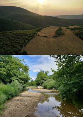
1. The landscape South-East of the Kastro at Kallithea with the Enipeas valley. Below, the Enipeas River.
The Central Achaia Phthiotis Survey (CAPS) is a new project that developed out of the previous Kastro Kallithea Archaeological Project (KKAP) which finished its fieldwork in 2013. This innovative landscape project, which had a pilot fieldwork season in July and August 2019, is co-directed by Sophia Karapanou of the Ephorate of Antiquities in Larissa and Dr. Margriet Haagsma of the University of Alberta. Dr. Lana Radloff of Bishop’s University is assistant director and staff members and specialists are coming from a variety of Greek, Canadian and Dutch Universities. Students from the University of Alberta and Bishop’s University participated in the archaeological field school. The project is supported by a SSHRC Insight Development Grant.
2. The CAPS team surveying field 999.
CAPS explores the landscape around the site of the Kastro at Kallithea in the region of Achaia Phthiotis, lying on the western end of the plain of Almiros, with the goal to increase our understanding of the interplay between environmental, geopolitical, cultural and social factors for the community/ies living in this region through time. Often labelled a ‘marginal’ landscape, this largely uncharted region forms an important node in inter- and intra-regional spatial networks; it sits at the crossroads between northern and southern Greece, is located between plains and mountains and connects territories near the sea with areas further inland. The landscape is characterized by fertile plains and rolling hills intersected by the Enipeas river and the Kotsiloremma running eastward from Aghios Antonios. The pilot year of CAPS focused on intensive survey of cultivated fields in the Kampos area, north of the Kastro, an area known as Arabises near Aghios Antonios and the mapping and study of Early Iron Age tholos tombs at the Kastro’s eastern and southern sides. Based on the results, we are busy developing a five year plan with subsequent field seasons starting in 2020.
3. Lana Radloff and Edward Middleton setting up the DGPS base station.
Access to this landscape is not always easy, but we received help from the municipality in the person of Vasilis who graded the most difficult roads for us. Every morning two survey teams set out, telephone in hand, to systematically survey parcels of about 0.5 hectares that were previously set out with the DGPS. The teams used two documentation strategies: paper forms and a digitized form accessible via an app, Survey 123, that is connected to our mapping software and which can be filled out on a mobile phone. All 12,000+ and 550 kilograms of pottery sherds and hundreds of additional artefacts, such as lithics and glass, have been counted, weighed and dated by the apothiki team. The integration of digitized survey documentation, mapping and apothiki work has already shown great advantages; Dr. Lana Radloff, who is the project’s GIS expert, has been able to start right away with visualizing the spatial dimensions of artefact density and dates. We determined that artifact densities diminish as distance increases from the Kastro, producing a halo around the base of the hill. Yet, recovered materials include a broad range of diagnostics, from Neolithic to modern; their relative quantity and composition pointing to specific areas of human activity, especially near Arabises which yielded Mycenaean, LHIIIC, EIA and Archaic/Classical material.
4. The excavation of Tholos 7 with the Kastro of Kallithea in the background.
A brief article, published in 1964, reported four looted tholos tombs dating to the Early Iron Age in the vicinity of the Kastro. These tombs had been mapped in previous years, but this summer CAPS added no less than 13 additional ones, bringing the total number of tholos tombs in the vicinity of the site up to 17. Not only is this a spectacular number; the location and positioning of these tombs in combination with evidence from the survey can tell us a lot about the transitional period between the Mycenaean periods and the Early Iron Age in this region. This summer, the team excavated one tomb. Despite the looting, the architecture and stratigraphy augmented by work of our osteoarchaeologist, Dr. Sandra Garvie-Lok, revealed that this tomb included the internment of two individuals in possibly two phases. The sparse ceramic evidence points to a protogeometric date, and we will send off the osteological material for C14 dating. We found evidence for commemorative activity near the stomion of the tomb in the form of a sacrifice and an incense burner.
5. Aerial of Tholos 7
6. Professor Konstantinos Vouvalidis standing near an exposed layer of Flysch at the Enipeas riverbed.
The project’s geologist, Dr. Markos Vaxevanopoulos, University of Lyon, and geomorphologist Prof. Konstantinos Vouvalidis of the Aristoteles University of Thessaloniki, have made a start with creating detailed geological and geomorphological maps of the designated survey area, a process that will be finalized later this year.
7. The Kastro Kallithea Guide Book
Last but not least, this summer saw the publication of the archaeological guide to the Kastro of Kallithea (available in English and Greek). A big thank you goes to the Municipality of Farsala for their important help in this endeavour. We are especially indebted to departing mayor Aris Karachalios and municipal archaeologist Vasso Noula for their support and friendship over the past ten years.
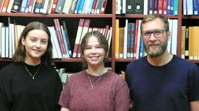
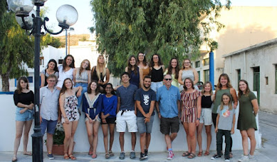
8. Part of the CAPS team with departing mayor Aris Karachalios, co-director Sophia Karapanou and municipal archaeologist Vasso Noula. Below: the full team.
The year 2019 saw a very successful beginning of CAPS. We would like to thank all who participated and aided this project and we are looking forward to our future seasons!
Margriet J. Haagsma
University of Alberta, Co-Director of the Central Achaia Phthiotis Survey

